


Autour des Baux de Provence

kephas
User
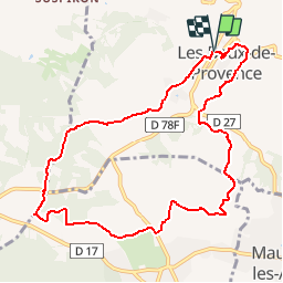

Length
10.6 km

Max alt
199 m

Uphill gradient
278 m
Km-Effort
14.3 km

Min alt
38 m

Downhill gradient
274 m
Boucle
Yes
Creation date :
2019-09-12 19:54:16.874
Updated on :
2019-09-12 20:00:20.735
--
Difficulty : Easy

FREE GPS app for hiking
 SityTrail
IGN / Geographical institutes
SityTrail Plus
The world is yours!
About
Trail On foot of 10.6 km to be discovered at Provence-Alpes-Côte d'Azur, Bouches-du-Rhône, Les Baux-de-Provence. This trail is proposed by kephas.
Positioning
Country:
France
Region :
Provence-Alpes-Côte d'Azur
Department/Province :
Bouches-du-Rhône
Municipality :
Les Baux-de-Provence
Location:
Unknown
Start:(Dec)
Start:(UTM)
644392 ; 4845115 (31T) N.
Comments